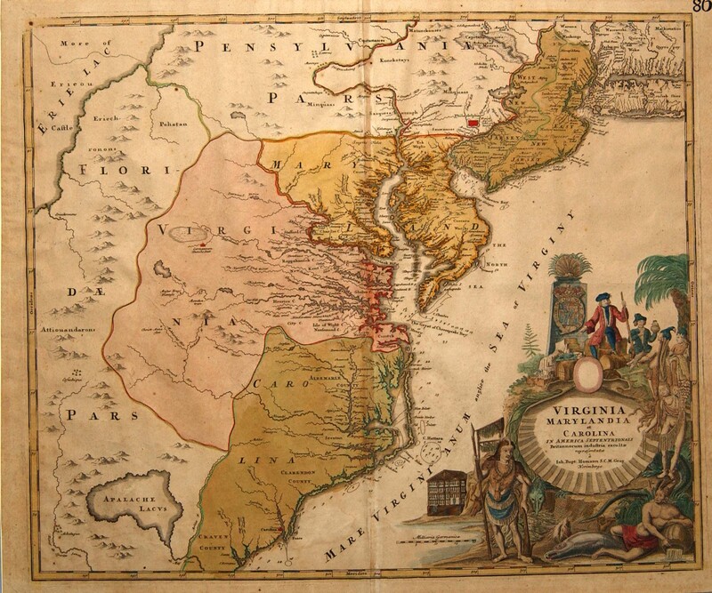
Virginia, Marylandia et Carolina…
Dublin Core
Title
Virginia, Marylandia et Carolina…
Subject
Maryland--Maps
Virginia--Maps
North Carolina--Maps
South Carolina--Maps
Description
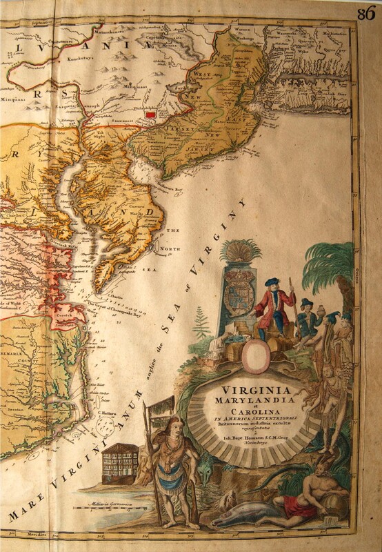
Hand-colored, engraved map: VIRGINIA MARYLANDIA et CAROLINA in America Septentroinali Britannorum industria excultae reparasentae a Ioh. Bapt. Homann S.C.M. Geog. Norimbergae [cartouche, lower right] | 86 [upper right corner, outside plate mark]
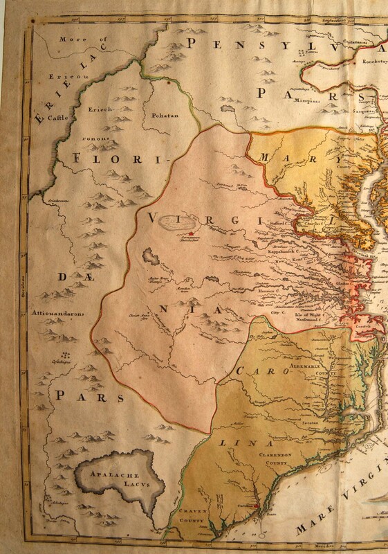
This map extends from New York and “New Jarsey” to South Carolina and west to Lake Erie. The map first appeared in Homann’s Atlas Novus, 1714. Its popularity is demonstrated in the number of other atlases in which it appeared during the eighteenth century. Beginning about 1730 and in later copies, the line “Cum Privilegio Sac. Maes. Majest.” appears in the cartouche below “Norimbergae.”
The elaborate cartouche includes images of European merchants trading with the Indians. On the left is an open drying shed; below a large fish, an alligator and a horse. The location of several important cities/towns—Philadelphia, “Carolina” (on the Cape Fear River in North Carolina), and “Germantown/ Teutsche Statt” (on the southern branch of the Rappahannock River in Virginia)—is picked out in red.
Johann Baptist Homann (1664-1724), a native of Nuremberg, started his career as a map engraver, but in 1702 he set up his own publishing house. A commercial success, Homann built up a stock of atlas plates and sold his maps at lower prices than the Dutch or French, who until then dominated the market. (Many of Homann’s maps were copied from Dutch or French sources.) Homann was responsible for re-establishing the languishing German map industry. In 1715 he was rewarded for his services by being appointed Geographer to the Emperor.
Creator
Homann, Johann Baptist
Source
Tryon Palace
Publisher
Homann, Johann Baptist
Date
1714-1730
Rights
Permission to use the photograph must be obtained in writing from Tryon Palace Historic Sites & Gardens, New Bern, North Carolina. It must be accompanied by the caption” From the collection of Tryon Palace Historic Sites & Gardens, New Bern, North Carolina; North Carolina Department of Cultural Resources, Division of Archives and History.”
Format
jpg
Language
Latin
German
English
Type
Maps
Identifier
TP.1959.055.007
Coverage
Maryland
Virginia
North Carolina
South Carolina
Still Image Item Type Metadata
Original Format
Maps
Physical Dimensions
Paper: 20 9/16” X 24 ¾”
Plate: 19 3/8” X 23”
Image: 19 ½” X 22 5/8”
Plate: 19 3/8” X 23”
Image: 19 ½” X 22 5/8”
Collection
Citation
Homann, Johann Baptist, “Virginia, Marylandia et Carolina…,” Craven County Digital History, accessed February 19, 2026, https://kellenberger.mycprl.org/digital/items/show/614.
Position: 301 (54 views)


