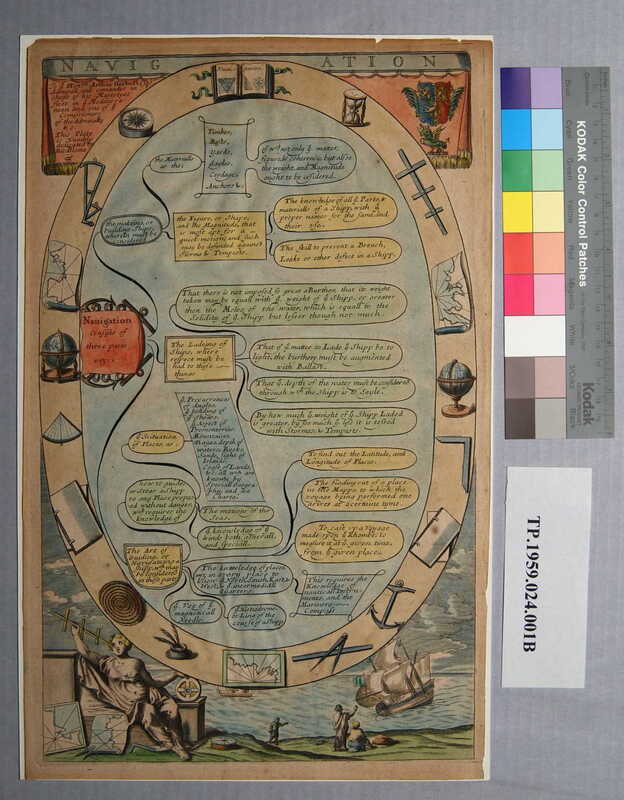
Navigation
Dublin Core
Title
Navigation
Subject
World--Maps
Description
Colored engraving: Navigation [title] | To ye Honble Arthur Herbert Esqr Admiral and commander in chiefe of his Majestys fleet in ye Mediterra=nean and one of the Commissioners of the Admiralty &c. This plate is Humbly dedicated by Ricd Blome. [top left] | Coat of arms [top right]; seated female figure with navigational tools [bottom left], figures on shore waving to a departing ship [bottom right]
English cartographer Richard Blome (died 1707) is best known for his county maps decorated with cartouches and coats of arms.
Gift, in memory of Lieut. (Senior Grade) Ellegood Vaughan Griffin, Jr. U.S.N.R. (1928-1959)
English cartographer Richard Blome (died 1707) is best known for his county maps decorated with cartouches and coats of arms.
Gift, in memory of Lieut. (Senior Grade) Ellegood Vaughan Griffin, Jr. U.S.N.R. (1928-1959)
Creator
Blome, Richard
Source
Tryon Palace
Publisher
Unknown
Date
1678-1700
Rights
Permission to use the photograph must be obtained in writing from Tryon Palace Historic Sites & Gardens, New Bern, North Carolina. It must be accompanied by the caption” From the collection of Tryon Palace Historic Sites & Gardens, New Bern, North Carolina; North Carolina Department of Cultural Resources, Division of Archives and History.”
Relation
Companion to print: “Geography” (TP.1958.024.001A) by Richard Blome
Format
jpg
Language
English
Type
Maps
Identifier
TP.1959.024.001B
Coverage
World
Still Image Item Type Metadata
Original Format
Maps
Physical Dimensions
Paper- 16 1/8” X 10”
Plate- 15 ½” X 9 13/16”
Image- 15 5/16” X 9 9/16”
Plate- 15 ½” X 9 13/16”
Image- 15 5/16” X 9 9/16”
Collection
Citation
Blome, Richard, “Navigation,” Craven County Digital History, accessed February 19, 2026, https://kellenberger.mycprl.org/digital/items/show/619.
Position: 158 (103 views)
