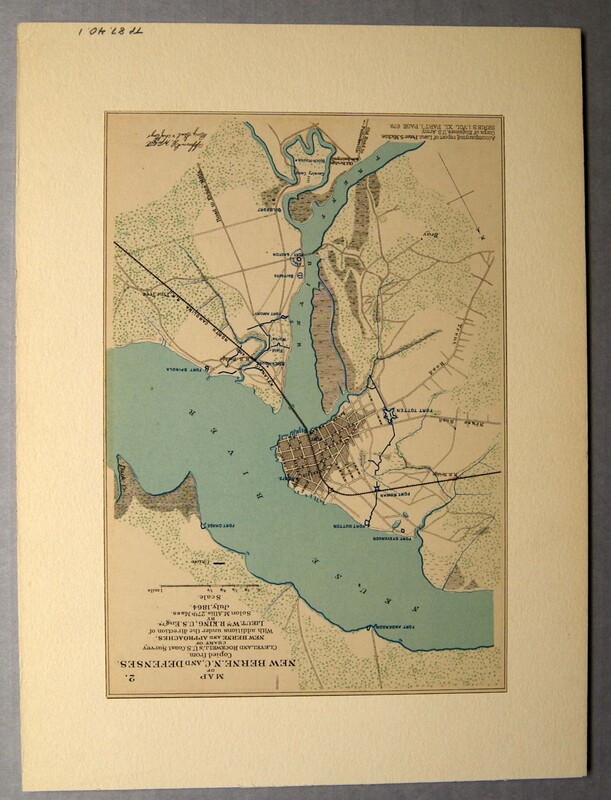
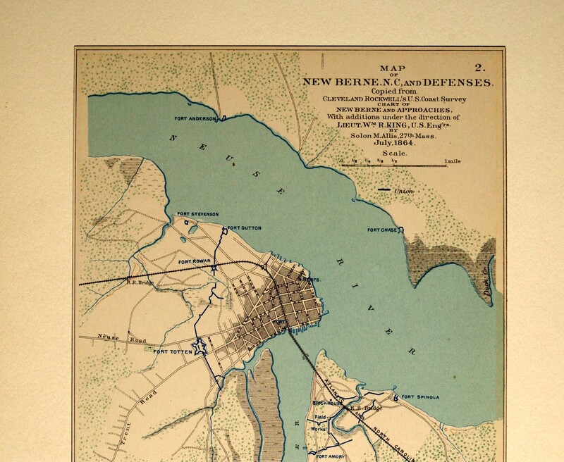
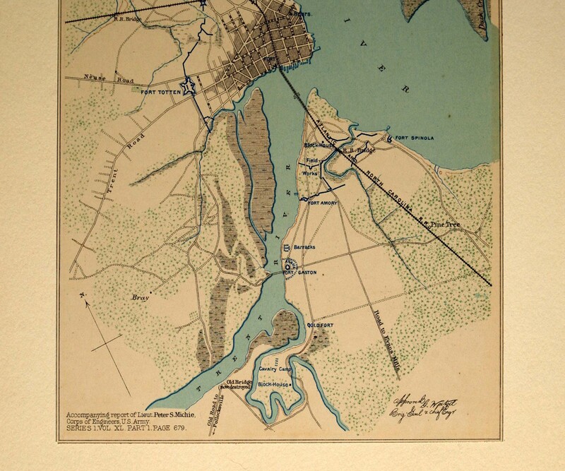
Map of New Berne, N.C. and Defenses…
Dublin Core
Title
Map of New Berne, N.C. and Defenses…
Subject
New Bern (N.C.)--Maps
New Bern (N.C.)--History--Civil War, 1861-1865--Maps
Description
Colored lithograph: Map of NEW BERNE, N. C. and DEFENSES. Copied from Cleveland Rockwell’s U.S. Coast Survey Chart of New Berne and Approaches, with additions under the direction of Lieut. Wm R. King, U. S. Engirs by Solon M. Allis, 27th Mass., July 1864. [top right] | Accompanying report of Lieut. Peter S. Michie, Corps of Engineers, U. S. Army, Series 1, Vol. XL, Part 1. Page 679.” [lower left, inside neat line] | Approved B G Weitzel Brig Genl + Chief Engr [lower right, inside neat line]
Inset cut from larger plate CXXXI, Atlas to Accompany the Official Records of the Union and Confederate Armies, Washington, D.C.: Government Printing Office, 1891-1895.
Inset cut from larger plate CXXXI, Atlas to Accompany the Official Records of the Union and Confederate Armies, Washington, D.C.: Government Printing Office, 1891-1895.
Creator
Allis, Solon M.
Source
Tryon Palace
Publisher
Government Printing Office
Date
1864, 1891
Rights
Permission to use the photograph must be obtained in writing from Tryon Palace Historic Sites & Gardens, New Bern, North Carolina. It must be accompanied by the caption” From the collection of Tryon Palace Historic Sites & Gardens, New Bern, North Carolina; North Carolina Department of Cultural Resources, Division of Archives and History.”
Relation
Inset cut from larger plate CXXXI, Atlas to Accompany the Official Records of the Union and Confederate Armies, Washington, D.C.: Government Printing Office, 1891-1895.
Format
jpg
Language
English
Type
Maps
Identifier
TP.1987.040.001
Coverage
North Carolina, New Bern
Still Image Item Type Metadata
Original Format
Maps
Physical Dimensions
Cut to neat lines and mounted on mat board.
Image: 9 1/8” X 6 ¼”
Image: 9 1/8” X 6 ¼”
Collection
Citation
Allis, Solon M., “Map of New Berne, N.C. and Defenses…,” Craven County Digital History, accessed February 18, 2026, https://kellenberger.mycprl.org/digital/items/show/623.
Position: 8 (154 views)


