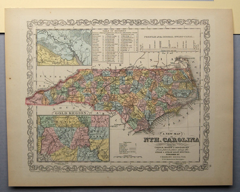
A New Map of North Carolina
Dublin Core
Title
A New Map of North Carolina
Subject
North Carolina--Maps
Description
Hand-colored lithograph, map of North Carolina counties: A New Map of NTH. CAROLINA With Its Canals, Roads & Distances from place to place, along the Stage & Steam Boat Routes. Published by Charles Desilver, No 251 Market Street, Philadelphia [title, lower right corner] | 18 [lower right corner] | Several insets: New Bern and the Neuse and Trent Rivers [inset, upper left], Table of Steamboat Routes and Distances from New Bern [inset, upper center] | Profile of the Dismal Swamp Canal [inset upper right] | Gold Region [lower left].
Creator
Unknown
Source
Tryon Palace
Publisher
Desilver, Charles
Date
1856
Rights
Permission to use the photograph must be obtained in writing from Tryon Palace Historic Sites & Gardens, New Bern, North Carolina. It must be accompanied by the caption” From the collection of Tryon Palace Historic Sites & Gardens, New Bern, North Carolina; North Carolina Department of Cultural Resources, Division of Archive and History.”
Format
jpg
Language
English
Type
Maps
Identifier
TP.1987.038.001
Coverage
North Carolina
Still Image Item Type Metadata
Original Format
Maps
Physical Dimensions
Paper: 13 ¾” X 17 ¼”
Image: 11 5/8” X 13 13/16”
Image: 11 5/8” X 13 13/16”
Collection
Citation
Unknown, “A New Map of North Carolina,” Craven County Digital History, accessed February 19, 2026, https://kellenberger.mycprl.org/digital/items/show/625.
Position: 458 (39 views)
