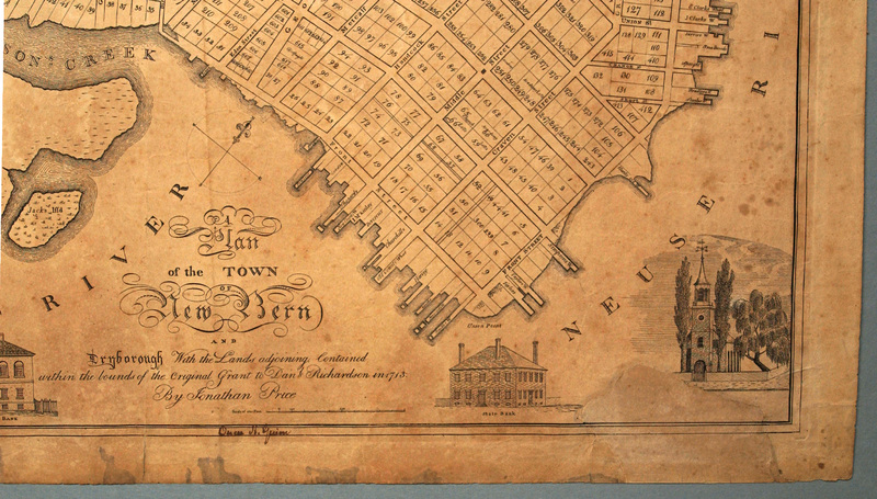
Plan of the town of New Bern and Dryborough…
Dublin Core
Title
Plan of the town of New Bern and Dryborough…
Subject
New Bern (N.C.)
Description
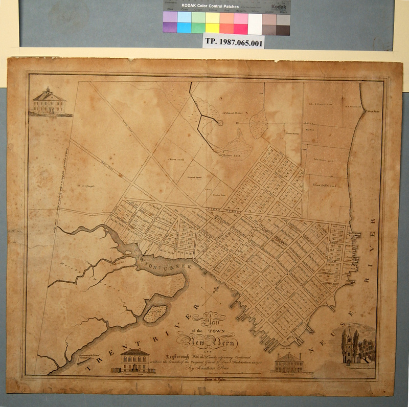
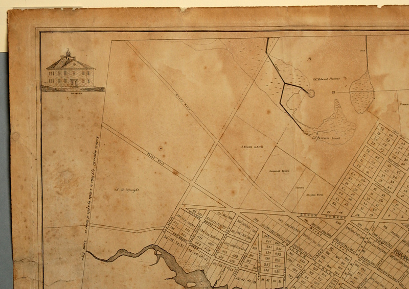
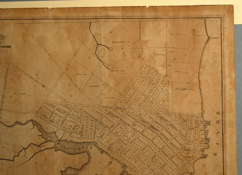
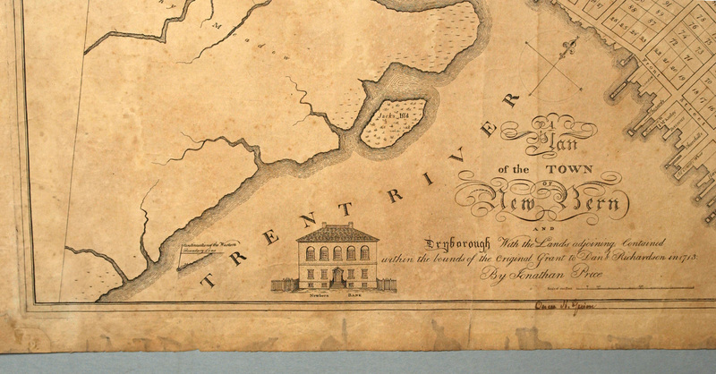
Engraved map: A Plan of the Town of New Bern and Dryborough With the Lands adjoining Contained within the bounds of the Original Grant to Danl Richardson in 1713 By Jonathan Price [title] | Owen H. Guion [in ink in lower neat lines] | Owen H. Guion [in ink on reverse] | Engraved vignettes of prominent New Bern buildings: Academy [upper left corner] | New Bern Bank [left of title] | State Bank [right of title] | Christ Church [lower right corner]
Although not a native, cartographer Jonathan Price (d. 1822) grew up in Pasquotank County and all his work is associated with North Carolina. From 1789 to 1794, Price served as surveyor for Pasquotank County. At about the same time he envisioned producing a map of the state based on actual surveys of its boundaries and coastal waters. This plan finally reached fruition with the publication of the Price and Strother map in1808, a privately financed project. About the same time, Price began a series of town surveys. In 1809, the City of New Bern commissioned him to resurvey the town and the new cornerstones of the squares. The survey of New Bern was published about 1817 incorporating material from an 1806 survey that had laid out the lots and street on the property of the Dry family lying to the north of the town beyond Qyeen Street. After his death in 1822, his administrator Joseph Bell purchased the plate (for ten dollars) and had it further engraved with views of the recently completed Presbyterian Church (1822) and the new Christ Church (1824). Bell then struck fresh impressions from the altered plates. These later prints are more widely circulated than Price’s c. 1817 version.
Although not a native, cartographer Jonathan Price (d. 1822) grew up in Pasquotank County and all his work is associated with North Carolina. From 1789 to 1794, Price served as surveyor for Pasquotank County. At about the same time he envisioned producing a map of the state based on actual surveys of its boundaries and coastal waters. This plan finally reached fruition with the publication of the Price and Strother map in1808, a privately financed project. About the same time, Price began a series of town surveys. In 1809, the City of New Bern commissioned him to resurvey the town and the new cornerstones of the squares. The survey of New Bern was published about 1817 incorporating material from an 1806 survey that had laid out the lots and street on the property of the Dry family lying to the north of the town beyond Qyeen Street. After his death in 1822, his administrator Joseph Bell purchased the plate (for ten dollars) and had it further engraved with views of the recently completed Presbyterian Church (1822) and the new Christ Church (1824). Bell then struck fresh impressions from the altered plates. These later prints are more widely circulated than Price’s c. 1817 version.
Creator
Price, Jonathan
Source
Tryon Palace
Publisher
Fitch, Allen, eng.
Date
1817?
Rights
Permission to use the photograph must be obtained in writing from Tryon Palace Historic Sites & Gardens, New Bern, North Carolina. It must be accompanied by the caption” From the collection of Tryon Palace Historic Sites & Gardens, New Bern, North Carolina; North Carolina Department of Cultural Resources, Division of Archives and History.”
Format
jpg
Language
English
Type
Maps
Identifier
TP.1987.065.001
Coverage
North Carolina, New Bern
Still Image Item Type Metadata
Original Format
Maps
Physical Dimensions
Paper: 21 ¼” X 24 7/8”
Plate: 19 ¾” X 23 1/8”
Image: 19 3/8” X 22 7/8”
Plate: 19 ¾” X 23 1/8”
Image: 19 3/8” X 22 7/8”
Collection
Citation
Price, Jonathan, “Plan of the town of New Bern and Dryborough…,” Craven County Digital History, accessed February 19, 2026, https://kellenberger.mycprl.org/digital/items/show/637.
Position: 195 (91 views)
