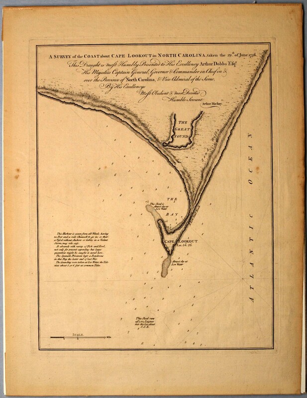
A Survey of the Coast about Cape Lookout in North Carolina…
Dublin Core
Title
A Survey of the Coast about Cape Lookout in North Carolina…
Subject
Cape Lookout (N.C.)--Maps
Description
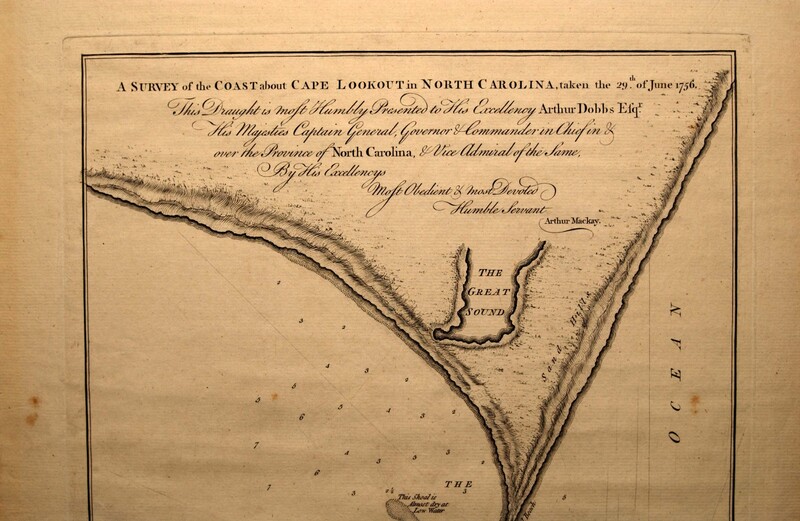
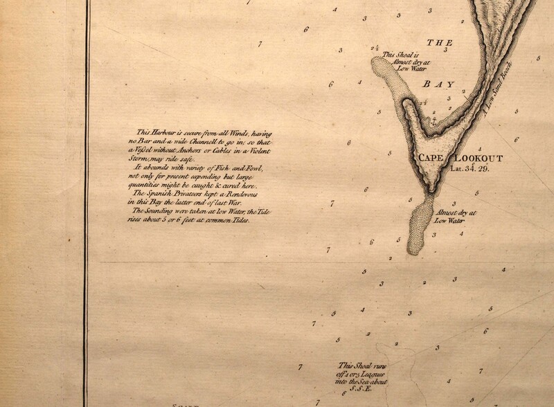
Engraved map: A Survey of the Coast about Cape Lookout in North Carolina, taken the 29th of June 1756. This Draught is most Humbly Presented to His Excellency Arthur Dobbs Esqr. His Majesties Captain General, Governor & Commander in Chief in & over the Province of North Carolina, & Vice Admiral of the Same, By His Excellencys Most Obedient & most Devoted Humble Servant Arthur Mackay. [top center, below the neat line] | This harbour is safe from all Winds, having no Bar and a wide Channell to go in; so that a Vessel without Anchors or Cables in a Violent storm, may ride safe. It abounds in a Variety of Fish and Fowl, not only for present expending but large quantities might be caught & cured here. The Spanish Privateers kept a Rendezvous in the Bay the latter end of the late war. The Soundings were taken at low Water, the Tide rises about 5 or 6 feet at common Tides. [lower left quadrant] | This Shoal was 4 or 5 leagues into the Sea about S.S.E. [lower left corner]
This well-drawn plan of Cape Lookout and the adjacent coast extending about ten miles along the shore on either side of the Cape includes soundings for the approach to the Cape. It was published in Thomas Jefferys’ A General Topography of North America and the West Indies (London, 1768) No. 58. The Spanish privateers mentioned in the text were marauders from St. Augustine, who plundered the North Carolina coast.
Arthur Dobbs (1689-1765) served as Royal Governor of North Carolina from 1754 until his death in 1765. Arthur Mackay was deputy to the Surveyor General of North Carolina in 1763.
Creator
Mackay, Arthur
Source
Tryon Palace
Publisher
Jefferys, Thomas
Date
1768
Rights
Permission to use the photograph must be obtained in writing from Tryon Palace Historic Sites & Gardens, New Bern, North Carolina. It must be accompanied by the caption” From the collection of Tryon Palace Historic Sites & Gardens, New Bern, North Carolina; North Carolina Department of Cultural Resources, Division of Archives and History.”
Format
jpg
Language
English
Type
Maps
Identifier
TP.1957.009.001
Coverage
North Carolina, Cape Lookout
Still Image Item Type Metadata
Original Format
Maps
Physical Dimensions
Paper: 17 ¾” X 13 3/8”
Plate: 14 ¼” X 11 13/16”
Image: 13 ¾” X 10 5/8”
Plate: 14 ¼” X 11 13/16”
Image: 13 ¾” X 10 5/8”
Collection
Citation
Mackay, Arthur, “A Survey of the Coast about Cape Lookout in North Carolina…,” Craven County Digital History, accessed February 26, 2026, https://kellenberger.mycprl.org/digital/items/show/608.
Position: 329 (51 views)


