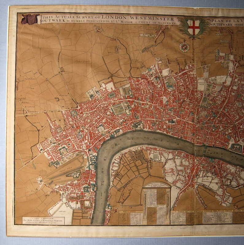
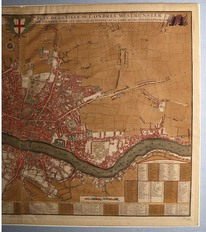
Survey of London Westminster Southwark…
Dublin Core
Title
Survey of London Westminster Southwark…
Subject
London (England)--Maps
Description
Colored engraving showing a plan of London, Westminster and Southwark: This Actual Survey of London Westminster Southwark is Humbly Dedicated to ye Ld Mayor & Court of Alderman § “Plan de la Ville de Londres Westmunster Southwark Dedié aux tres Nobles Seigneurs Le Lord Maire & Counseillers de la ville [title, across top] | Unidentified coat of arms [center top] | se Vendeut A Amsterdam, Chez Jean Covens et Corneille Mortier Libraires et Marchands des Cartes [lower left]. Across the bottom of the plan are various legends including a key to the wards listed on the map, a table of parishes within the walls, and lists of hospitals, halls and companies, markets, Inns of Court, prisons, palaces and public buildings.
Creator
Unknown
Source
Tryon Palace
Publisher
Covens, Jean
Mortier, Corneille
Date
1730-1750
Rights
Permission to use the photograph must be obtained in writing from Tryon Palace Historic Sites & Gardens, New Bern, North Carolina. It must be accompanied by the caption” From the collection of Tryon Palace Historic Sites & Gardens, New Bern, North Carolina; North Carolina Department of Cultural Resources, Division of Archive and History.”
Relation
See View of London (TP.1959.021.004)
Format
jpg
Language
English
French
Type
Maps
Identifier
TP.1959.021.054
Coverage
London, England
Still Image Item Type Metadata
Original Format
Maps
Physical Dimensions
Paper- 24 5/8” X 40”
Plate- 23 ½” X 38 ½”
Image- 22 5/8” X 38 ¼”
Plate- 23 ½” X 38 ½”
Image- 22 5/8” X 38 ¼”
Collection
Citation
Unknown, “Survey of London Westminster Southwark…,” Craven County Digital History, accessed February 18, 2026, https://kellenberger.mycprl.org/digital/items/show/617.
Position: 457 (39 views)

