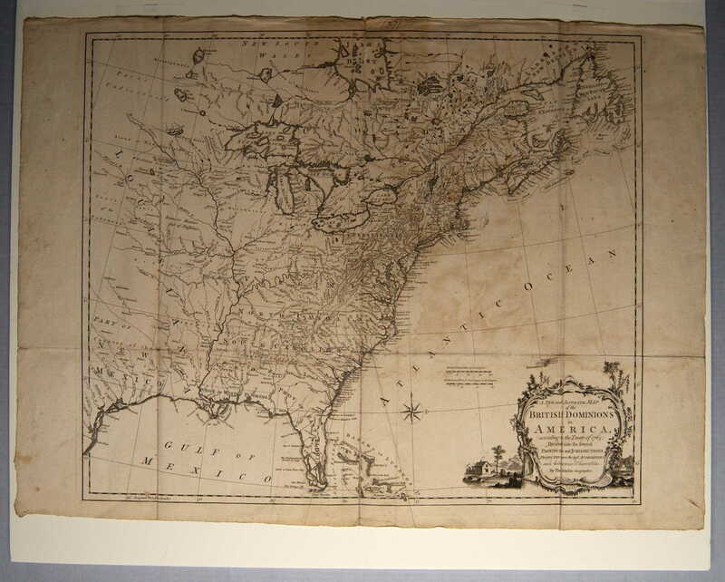
A New and Accurate map of the British Dominions in America...
Dublin Core
Title
A New and Accurate map of the British Dominions in America...
Subject
North America--Maps
Description
Engraved map: A New and Accurate MAP of the BRITISH DOMINIONS in America according to the Treaty of 1763; Divided into the several Provinces and Jurisdictions Projected upon the best Authorities and Astronomical Observations By Thos KITCHIN Geographer.” [cartouche, lower right corner]
Map illustrates the division of spoils after the 1763 Treaty at the end of the Seven Years War (known as the French and Indian War in America). Map covers the area from Newfoundland, Labrador and James Bay in Canada south to Florida and the Bahamas and west to beyond the headwaters of the Mississippi River. Location indicated for several Indian tribes. Areas west of the Mississippi River are described as “parts undiscovered,” “country full of mines,” and “extensive meadows full of Buffalo.”
Engraver Thomas Kitchin (1718-1784) was hydrographer to the Duke of York and later to King George III. As hydrographer, he studied, described and mapped bodies of water with reference to navigational and commercial uses.
Creator
Unknown
Source
Tryon Palace
Publisher
Kitchin, Thomas, eng.
Date
1770?
Rights
Permission to use the photograph must be obtained in writing from Tryon Palace Historic Sites & Gardens, New Bern, North Carolina. It must be accompanied by the caption” From the collection of Tryon Palace Historic Sites & Gardens, New Bern, North Carolina; North Carolina Department of Cultural Resources, Division of Archives and History.”
Format
jpg
Language
English
Type
Maps
Identifier
TP.2001.002.001
Coverage
North America
Still Image Item Type Metadata
Original Format
Maps
Physical Dimensions
Paper: 22” X 30 1/8”
Plate: 21 ¼” X 24 13/16”
Image: 20 5/8” X 24 ½”
Plate: 21 ¼” X 24 13/16”
Image: 20 5/8” X 24 ½”
Collection
Citation
Unknown, “A New and Accurate map of the British Dominions in America...,” Craven County Digital History, accessed February 18, 2026, https://kellenberger.mycprl.org/digital/items/show/630.
Position: 369 (46 views)
